
[Andros Administrators]
[Councillors Contacts]
 |
 |
| Lat.: N24 42' 00" Long.: W77 50' 00" Size: 2,300 Sq. mls |
Island Crest |
ANDROS
Island Information
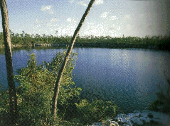 Andros is the largest island in The Bahamas. It is 104 miles long and 40 miles wide. It lies in the Atlantic Ocean and is made up of many islets and cays, comprising a North, Middle and South Bight. There is much shallow water and swamp, some of which connect with fresh water streams. Andros, known for its abundant fresh water supplies, has an atmosphere of mystery, having its forested and remote areas. Legend has it that a sort of leprechaun or gremlin known locally as the ‘chickcharney” holds sway and migrated to Red Bay in the 19th century with the Seminole Indians.
The island was given the name “Espiritu Santo,” the " Island of the Holy Spirit” by the Spanish, but is also called San Andreas on a 1782 map. The modern name is believed to be in honour of Sir Edmund Andros, Commander of Her Majesty’s Forces in Barbados in 1672 and Governor successively of New York, Massachusetts and New England. It is also believed that the island could have been named after the inhabitants of St. Andro Island on the Mosquito Coast as 1,400 of them settled in Andros in 1787.
Loyalists and their slaves also settled in Andros in the late 19th Century. Cotton and sisal were grown and later sponging became a flourishing industry in Andros for many years.
Located 20 miles west of New Providence, Andros has four airports and three official ports of entry. It is also home to the Atlantic Undersea Testing and Evaluation Centre(AUTEC) Base in Fresh Creek, one of the world’s busiest underwater testing facilities; and the Androsia factory established by Rosie Birch and produces batik with exquisite local design; bonefishing lodges, blue holes, caves, and the world’s third largest barrier reef. Other settlements are San Andros, Nicholls Town, Lowe Sound, Staniard Creek, Mangrove Cay, Driggs Hill, Kemps Bay, Long Bay Cays, The Bluff, Deep Creek, Little Creek Pleasant Bay, Mars Bay, Smith’s Hill, Black Point, Behring Point, Cargill Creek, Calabash Bay, Love Hill and Stafford Creek.
Information courtesy of Bahamas Information Services, Department of Archives and Local Government.
For more information visit the Website of the Ministry of Tourism
-
 Public Consultation on The Draft Pension Bill, 2023See details...
 -
 Vacancy Notice - Public ProsecutorsSee details...